


 Books by Category
 Back
Back

-

Argentina
-

Australia
-

Austria
-

Bangladesh
-

Belgium
-

Bhutan
-

Brazil
-

Bulgaria
-

Cambodia
-

Canada
-

China
-

Croatia
-

Czechia
-

Denmark
-

Estonia
-

Finland
-

France
-

Germany
-

Greece
-

Hong Kong
-

Hungary
-

India
-

Indonesia
-

Iran (Islamic Republic of)
-

Ireland
-

Israel
-

Italy
-

Japan
-

Lao People's Democratic Republic
-

Luxembourg
-

Malaysia
-

Mexico
-

Morocco
-

Myanmar
-

Netherlands
-

New Zealand
-

Nigeria
-

Norway
-

Oman
-

Pakistan
-

Philippines
-

Poland
-

Portugal
-

Qatar
-

Republic of Korea
-

Romania
-

Russian Federation
-

Serbia
-

Singapore
-

Slovakia
-

Slovenia
-

South Africa
-

Spain
-

Sri Lanka
-

Sweden
-

Switzerland
-

Taiwan
-

Thailand
-

Turkey
-

United Arab Emirates
-

United Kingdom
-

United States of America
-

Vietnam
National Atlas of India, Land Use 1: 1,000 000, Kumaun
SIMILAR BOOKS
Show All
Fouce Paula, Denise Tomecko
Shiva
USD 25.00
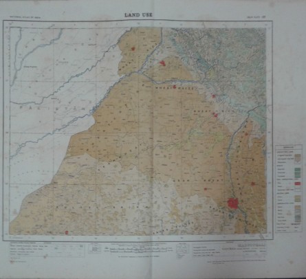
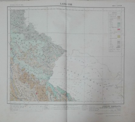
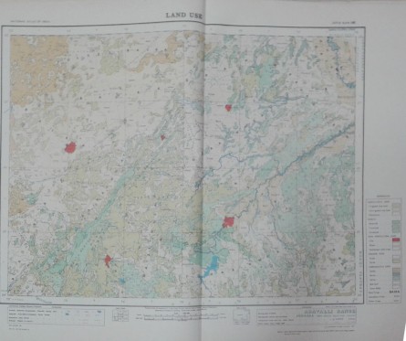


National Atlas of India, Land Use 1: 1,000 000, Kumaun
Himalaya, Kachchh Peninsula, Aravalli Range, Avadh Plains, North Bihar Plains, Malwa Plateau, Satpura Range, Bengal Basin, Maharashtra Plateau, Dandakaranya, Eastern Ghats, South Sahyadri, Purvachal, India Power Resources, India Growth of Industries, India Engineering Industries, India Wool & Silk
USD -
 ADD TO CART
 Standard Delivery
10 - 14 days
USD$ -
| PUBLISHER: | |
| ISBN: | |
| AUTHOR | State Forest Departments, Survey of India Maps |
| RELEASED |
| Calcutta,1981 | |
| WL CODE | N1369/5 |
| SIZE | 18 plates, chart in col, 510 x 590 mm |
| BOOK WEIGHT | 2.700 Kg |
| PACKING WEIGHT | 0.200 Kg |
RECOMMENDED CATEGORIES


OTHER BOOKS
Other books you might be interested in.
